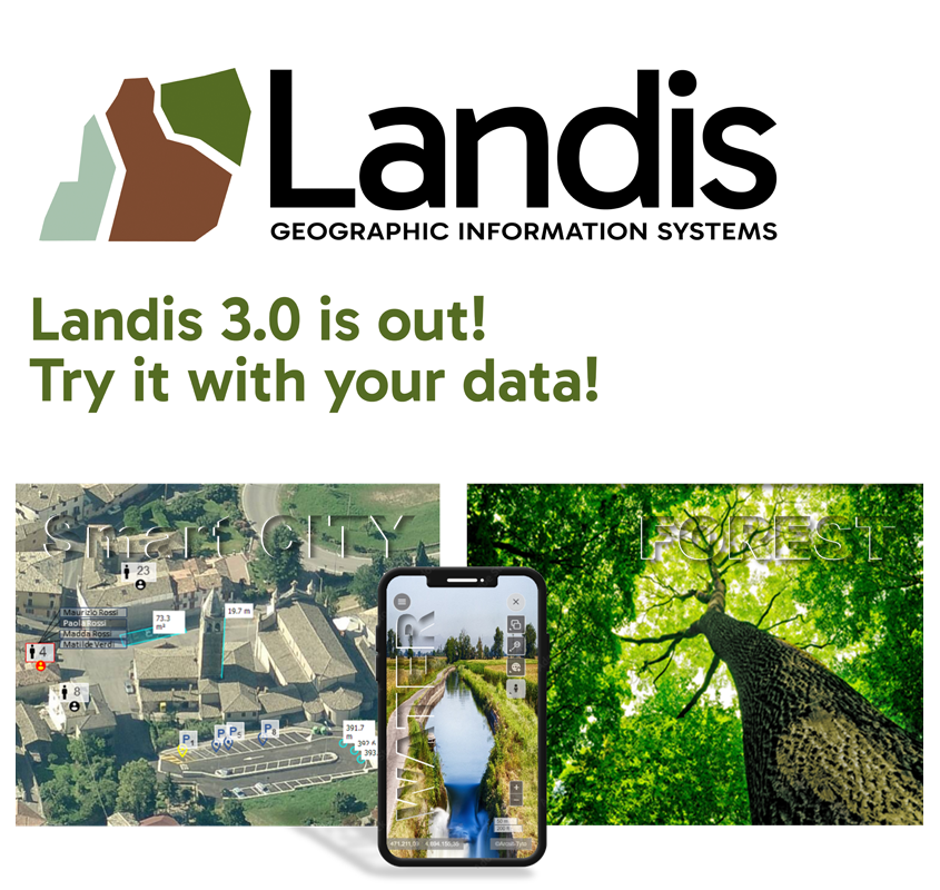
Web GIS designed to create and integrate services and data, easily map and share information by integrating different data sources. GIS and IoT, a perfect match, integrated into a platform for real-time IoT data collection to monitor and analyze events for prevention and early intervention.
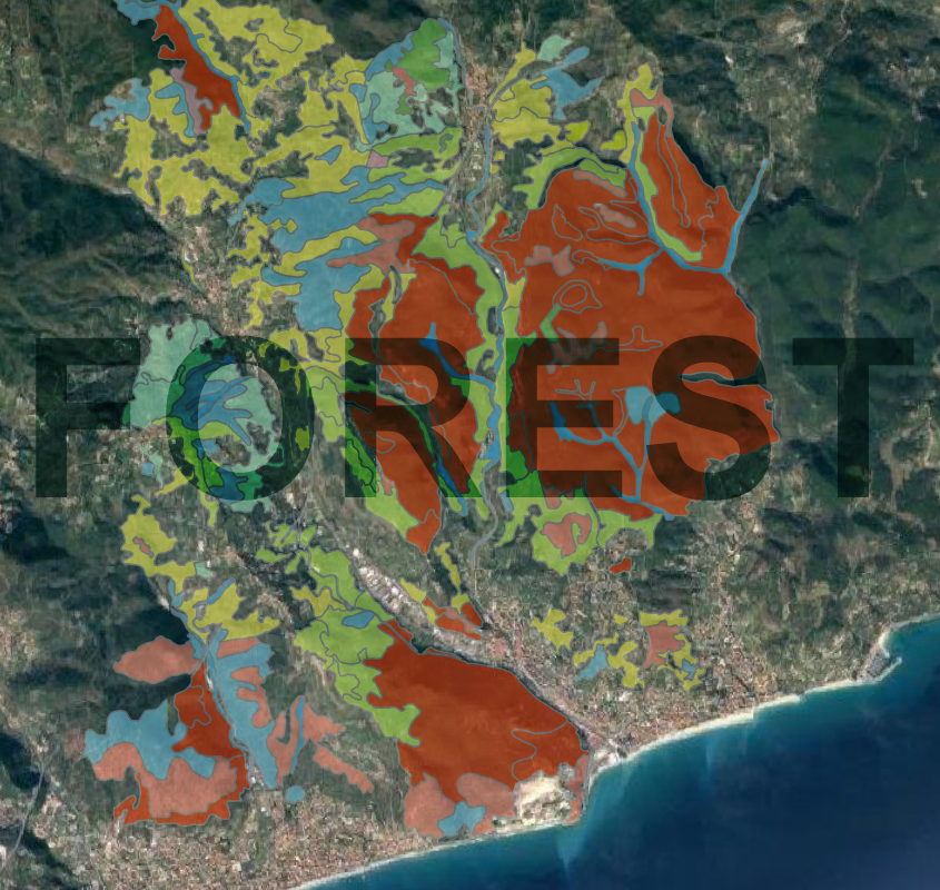
ARCADIA SIT in RTI with Dr. Umberto Bruschini will create the new version of the Forest Types map,for the entire regional territory, harmonizing the CF with the Corine Land Cover The project involves the use of Sentinel 2 images and classic photo-interpretation techniques.
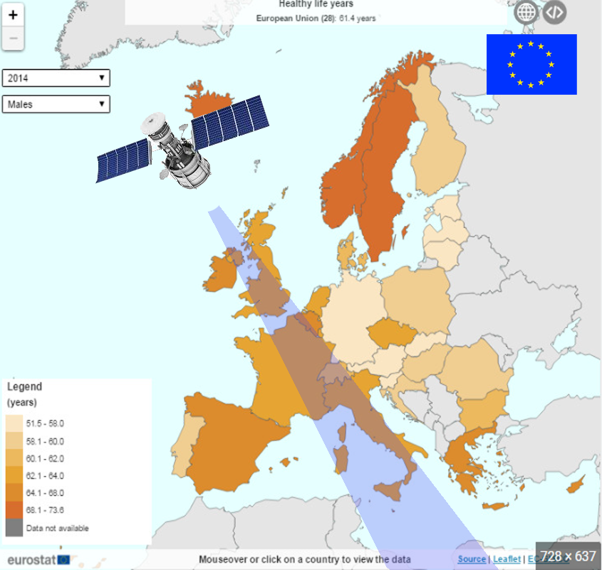
ARCADIA SIT in JV with Engeneering SPA is the component in the Framework Contract EU DIGIT II for the next four years to support the developments of the Joint Research Center in the field of GIS and Remote Sensing.
ARCADIA SIT with TYTO (IT Partner) participated in the Smart Life Summit in Bratislava - An event uniting minds from academia, business and municipal sectors for an extraordinary collaborative experience.

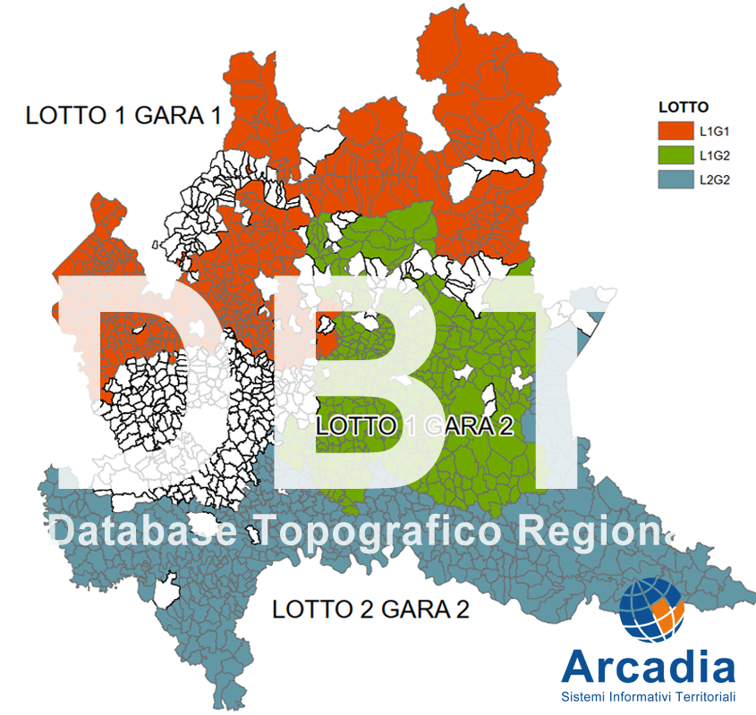
ARCADIA SIT, in temporary consortium with Impresa Rossi Luigi and RTA, was awarded 3 lots for the update of the regional DBT. The project includes the update of 1155 Lombardy municipalities and adaptation to the latest Intesa Gis specifications
ARCADIA SIT in JV with Engeneering SPA is the component in the Framework Contract EU DIGIT II for the next four years to support the developments of the Joint Research Center in the field of GIS and Remote Sensing.
Web GIS designed to create and integrate services and data, easily map and share information by integrating different data sources. GIS and IoT, a perfect match, integrated into a platform for real-time IoT data collection to monitor and analyze events for prevention and early intervention.
ARCADIA SIT with TYTO (IT Partner) participated in the Smart Life Summit in Bratislava - An event uniting minds from academia, business and municipal sectors for an extraordinary collaborative experience.
ARCADIA SIT in RTI with Dr. Umberto Bruschini will create the new version of the Forest Types map,for the entire regional territory, harmonizing the CF with the Corine Land Cover The project involves the use of Sentinel 2 images and classic photo-interpretation techniques.
ARCADIA SIT, in temporary consortium with Impresa Rossi Luigi and RTA, was awarded 3 lots for the update of the regional DBT. The project includes the update of 1155 Lombardy municipalities and adaptation to the latest Intesa Gis specifications
ARCADIA SIT in JV with Engeneering SPA is the component in the Framework Contract EU DIGIT II for the next four years to support the developments of the Joint Research Center in the field of GIS and Remote Sensing.
ARCADIA SIT in JV with Engeneering SPA is the component in the Framework Contract EU DIGIT II for the next four years to support the developments of the Joint Research Center in the field of GIS and Remote Sensing.